
Antwerpen
Descripción
Province in northern Belgium.
Mapa

Senderos en estado
Enlaces
Datos
Informes
Guías y mapas
Hospedaje
Organizaciones
Operadores turísticos
GPS
Otro
Libros

Stanfords
United Kingdom
United Kingdom
- Bruges, Ghent and Antwerp Insight City Guide OUT OF PRINT
- Bruges, Ghent and Antwerp in the City Guide series from Insight provides a detailed exploration of a range of destinations and includes extensive information on restaurants, hotels, shopping and sights as well as unique ‘editor’s tips’. Each heavily illustrated guide begins with ‘best of’ sections, giving a brief summary of the main highlights.... Leer más

Stanfords
United Kingdom
2019
United Kingdom
2019
- Du Léman à la Vanoise - par le Mont Blanc et le Beaufortain GR5
- The first, 206-km long Alpine section of the GR5 from Lake Geneva, past Mont Blanc and across the Col de la Croix-du-Bonhomme, to Landry north of the Vanoise Massif, FFRP topo-guide ref. no. 504, with colour maps from the IGN TOP25 series at 1:25,000. Also included is a tour of the Dents du Midi. Current edition of this title was published in... Leer más

Stanfords
United Kingdom
2021
United Kingdom
2021
- Tour de l`Oisans et des Ecrins - Parc National des Ecrins GR54/GR541
- Tour de l`Oisans et des Ecrins, FFRP topoguide, Ref. No. 508, covering the 11 to 13 days long tour of the Ecrins massif along the GR54, including the local section of the GR5. Variants along GRs 54A, 54B, 54C, and 541 offer less demanding circuits of two to three days. Current edition of this title was published in April 2014.To see other... Leer más

Stanfords
United Kingdom
2019
United Kingdom
2019
- La Traversée des Alpes de la Maurienne a l`Ubaye GR5/GR56
- 9 days from Modane to Larche by the GR5, as much for the tour of Ubaye.Grande Traversée des Alpes: de la Maurienne a l`Ubaye, FFRP topoguide Ref. No. 531, covering the third stage of the GR5 in the French Alps from Modane to Larche, plus the Tour de l`Ubaye at its southern end, in all 272km for hiking routes. Current edition of this title was... Leer más
Stanfords
United Kingdom
2019
United Kingdom
2019
- La Grande Traversee du Jura GR5/GR9/GTJ
- La Grande Travesée du Jura, FFRP topoguide Ref. no. 512, covering the GTJ along the Jura Mountains in France from Nommay to Culoz, plus several variants off the main route including parts of the GR5 and GR9 – in all 509kms of hiking trails. Current edition of this title was published in March 2017.The GR509 offers hikers a path punctuated by... Leer más
Stanfords
United Kingdom
2020
United Kingdom
2020
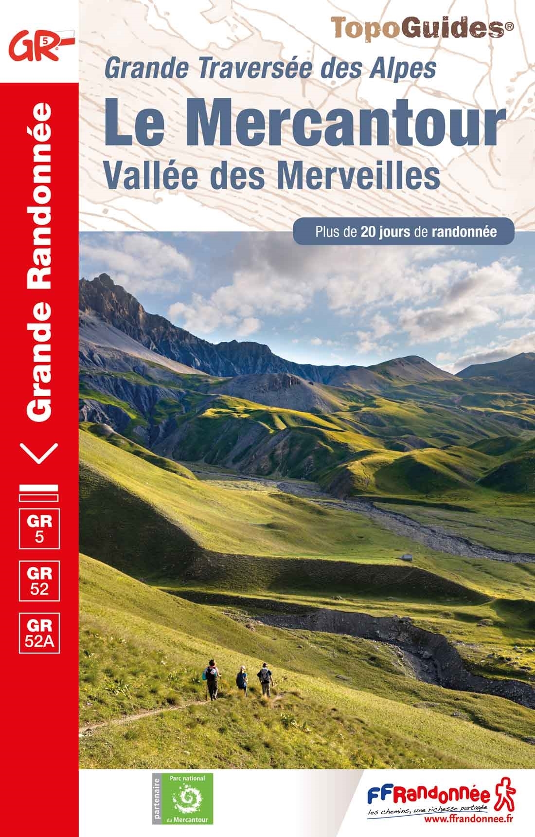
- Le Mercantour - Vallee des Merveilles GR5/GR52/52A
- Le Mercantour: Larche – Nice/Menton, Vallée des Merveilles, FFRP topoguide Ref. No. 507, covering 450km of long-distance routes: the last section of the GR5 in the French Alps from Larche to Nice, an alternative variant off GR5 along the GR52 leading via the Vallée des Merveilles to Menton, plus GR52A – Panoramique du Mecantour from Col du... Leer más
Stanfords
United Kingdom
2020
United Kingdom
2020
- La Traversee der Alpes La Vanoise - PN de la Vanoise GR5/GR55
- 15 days in altitude from the Tarentaise to Modane, heart of the Maurienne. Description also of Via Alpina.La Vanoise (including Parc National de la Vanoise), FFRP topoguide Ref. no. 530, covering the second section of the GR5 in the French Alps between Landry and Modane, its lower variant on the GR5E along the river Arc, plus the traverse of... Leer más


- Also available from:
- De Zwerver, Netherlands


- Also available from:
- De Zwerver, Netherlands

De Zwerver
Netherlands
2021
Netherlands
2021

The Book Depository
United Kingdom
2018
United Kingdom
2018
- The GR5 Trail - Benelux and Lorraine
- The North Sea to Schirmeck in the Vosges mountains Leer más
- Also available from:
- De Zwerver, Netherlands

De Zwerver
Netherlands
2018
Netherlands
2018
- Wandelgids The GR5 Trail Benelux and Lorraine | Cicerone
- Guidebook to walking the northern section of the GR5 - 1000km starting in Hoek van Holland and passing through the Netherlands, Belgium, Luxembourg and Lorraine to Schirmeck in France. A long-distance route covering a variety of cultures and landscapes. The full GR5 from the North Sea to the Mediterranean is one of the world's greatest trails. Leer más


De Zwerver
Netherlands
2009
Netherlands
2009
- Wandelgids GR 5 Mer Du Nord-Mediterrannee Noordzee - Middellandse Zee deel Ardennen (Maastricht - Diekirch ) | GR Sentiers
- LET OP: deze wandelgids van dit deel van de GR5 is alleen nog maar in het Frans leverbaar. De Nederlandstalige versie is geheel uitverkocht, niet meer te bestellen en er komt naar alle waarschijnlijkheid geen nieuwe versie in het Nederlands! Uitstekende routegids met gedetailleerde kaarten en een routebeschrijving. Fout lopen wordt op deze... Leer más

Bol.com
Netherlands
Netherlands
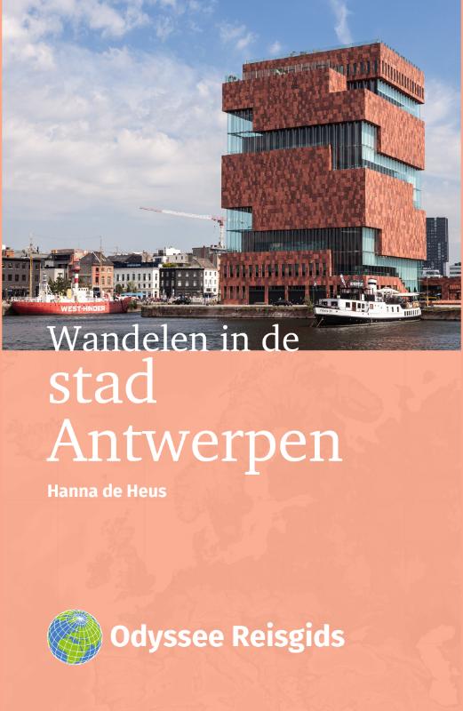
- 100% Antwerpen
- 100% Antwerpen Of je nu gaat voor sightseeing, shoppen, culinair genieten of avontuur; met deze gids op zak ontdek je ANTWERPEN in no time. De leukste bezienswaardigheden, musea, parken, restaurants, caf s en winkels zijn overzichtelijk ingedeeld per stadsdeel. Zes wandelingen leiden je overdag langs ALLE MOOIE PLEKKEN. Voor 's avonds zijn er... Leer más
- Also available from:
- Bol.com, Belgium
Bol.com
Belgium
Belgium
- 100% Antwerpen
- 100% Antwerpen Of je nu gaat voor sightseeing, shoppen, culinair genieten of avontuur; met deze gids op zak ontdek je ANTWERPEN in no time. De leukste bezienswaardigheden, musea, parken, restaurants, caf s en winkels zijn overzichtelijk ingedeeld per stadsdeel. Zes wandelingen leiden je overdag langs ALLE MOOIE PLEKKEN. Voor 's avonds zijn er... Leer más
Mapas

Stanfords
United Kingdom
United Kingdom
- 2130 Westerschelde and Oosterschelde Chart Atlas - 2018 edition SUPERCEDED
- Part of Imray’s popular small format chart coverage for the Netherlands, this atlas is a convenient A2 format, wirobound along one edge. Includes download code for more than 140 digital charts covering all of the Netherlands on the Imray Navigator charts app.Includes extensive coverage of Westerschelde, Kanaal Gent-Terneuzen, Oosterschelde,... Leer más

Stanfords
United Kingdom
United Kingdom
- Autour du Thabor: Modane - Bardonecchia - Briançon
- Mont Thabor area at 1:50,000 on a contoured and GPS compatible map from Editions Didier Richard in their series of walking maps of French Alps and other popular hiking regions of south-eastern France. Coverage extends from Modane in the north to Briançon in the south-east, and west to Valloire.The base map with cartography from the IGN has... Leer más

Stanfords
United Kingdom
United Kingdom
- Antwerp Kempen Falkplan Cycling Map 32
- The Antwerp province of Belgium at 1:50,000 in a series from Falk B.V. showing the network of signposted cycling routes on large, double-sided indexed maps with prominent highlighting of long-distance LF routes, symbols indicating accommodation and other tourist services, plus in each title two or more panels with recommended local circuits and... Leer más

Stanfords
United Kingdom
United Kingdom
- Alsace - Mulhouse - Basel - Altkirch K+F Outdoor Map 2
- The southern part of Alsace around Mulhouse and Guebwiller on a GPS compatible, double-sided map at 1:50,000 from Kümmerly+Frey printed on sturdy, waterproof and tear-resistant synthetic paper; contoured, with hiking and cycling routes, sites for other recreational activities, various accommodation options, restaurants and ferme-auberge... Leer más

Stanfords
United Kingdom
United Kingdom
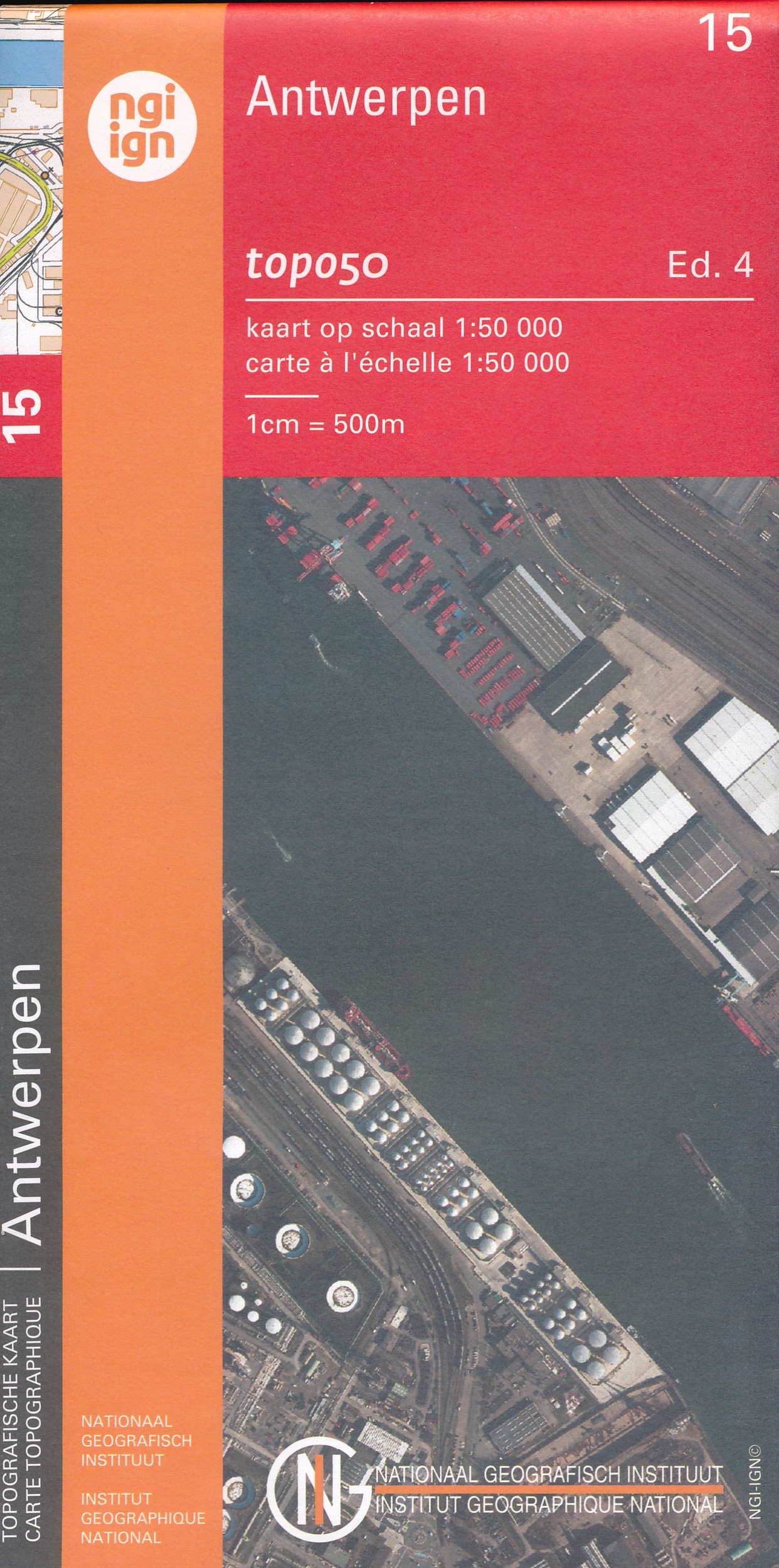
- Antwerp NGI Topo 15
- Topographical survey of Belgium at 1:50,000 from the country’s national survey organization, Nationaal Geografisch Instituut / Institut Géographique National. Contour interval varies according to the terrain, from 2.5 metres in the coastal areas to 10 metres in the Ardennes. The maps provide all the information expected of topographic mapping... Leer más

Stanfords
United Kingdom
United Kingdom
- 2130 Westerschelde and Oosterschelde Chart Atlas - 2019 edition
- Part of Imray’s popular small format chart coverage for the Netherlands, this atlas is a convenient A2 format, wirobound along one edge. Includes extensive coverage of Westerschelde, Kanaal Gent-Terneuzen, Oosterschelde, Veerse Meer, Zoommeer, plus canal links and North Sea coastal approaches.This 2019 edition has been fully updated throughout... Leer más

Stanfords
United Kingdom
United Kingdom
- Luxembourg North
- One of two topographic survey maps of Luxembourg at 1:50,000, with contours at 10-metres intervals and additional relief shading. An overprint highlights long-distance footpaths, including the GR5 (E-2), cycle routes, and various places of interest, including campsites. The map covers an area of approximately 53 x 43 km / 33 x 27 miles. Map... Leer más

Stanfords
United Kingdom
United Kingdom
- NL5 Ooster en Westerschelde
- Passage ChartsC1 Zuidelijke Noordzeekust · Zeeland 1:375.000RevierkartenC2 Westerschelde Monding 1:50.000 C3A Oosterschelde Monding 1:50.000 C3B Westerschelde · Vlissingen tot Braakman 1:50.000 C4 Westerschelde · Braakman tot Turfplaten 1:50.000 C5 Westerschelde · Turfplaten tot Antwerpen 1:30.000 C6 Antwerpen 1:30.000 C7A-C Kanaal Gent tot... Leer más

Stanfords
United Kingdom
United Kingdom
- Luxembourg South
- One of two topographic survey maps of Luxembourg at 1:50,000, with contours at 10-metres intervals and additional relief shading. An overprint highlights long-distance footpaths, including the GR5 (E-2), cycle routes, and various places of interest, including campsites. The map covers an area of approximately 53 x 43 km / 33 x 27 miles. Map... Leer más

- Also available from:
- De Zwerver, Netherlands


Stanfords
United Kingdom
2014
United Kingdom
2014
- Mercantour & Alpi-Marittime Didier Richard 07
- Mercantour National Park and the Maritime Alps on a large, double-sided, contoured and GPS compatible map from Editions Didier Richard highlighting local walking trails and long-distance hiking routes including the GR5. Coverage extends from well north of Col de Larch to Sospel, Levens and Roquestéron in the mountains north of the French... Leer más
- Also available from:
- De Zwerver, Netherlands

De Zwerver
Netherlands
2014
Netherlands
2014
- Wandelkaart 07 Mercantour & Alpi-Maritieme | Didier Richard
- Mercantour National Park and the Maritime Alps on a large, double-sided, contoured and GPS compatible map from Editions Didier Richard highlighting local walking trails and long-distance hiking routes including the GR5. Coverage extends from well north of Col de Larch to Sospel, Levens and Roquestéron in the mountains north of the French... Leer más


Stanfords
United Kingdom
2016
United Kingdom
2016
- Vanoise National Park - Beaufortain Didier Richard 04
- Vanoise National Park and the Beaufortain Massif in the French Alps at 1:60,000 on a contoured and GPS compatible map from Didier Richard with a base derived from IGN’s topographic survey, highlighting both local hiking routes and the GR network of long-distance paths, gîtes and mountain refuges, interesting natural and cultural sites, etc. The... Leer más
- Also available from:
- De Zwerver, Netherlands

De Zwerver
Netherlands
2016
Netherlands
2016
- Wandelkaart 04 Vanoise - Beaufortain | Didier Richard
- Vanoise National Park and the Beaufortain Massif in the French Alps at 1:60,000 on a contoured and GPS compatible map from Didier Richard with a base derived from IGN Leer más
De Zwerver
Netherlands
Netherlands
- Topografische kaart - Wandelkaart 15 Topo50 Antwerpen | NGI - Nationaal Geografisch Instituut
- Topografische kaart van een deel van Belgie, zie overzicht voor de juiste lokatie. Veel details met alle noodzakelijke informatie als hoogtelijnen, helder kleurgebruik voor onderscheid in bos, agrarische gebied, heide etc. Met grid, dus GPS toepasbaar. Het is een zuiver topografische kaart, de bewandelbare paden staan wel met lijntjes... Leer más