
Eifel
Descripción
Low mountain range in Germany, states of Rheinland-Pfalz and Nordrhein-Westfalen. Small parts extending into Luxembourg and Belgium.
Senderos en región
- Ahr-Venn-WegGPX
- AhrtalwegGPX
- E3GPX
- EifelsteigGPX
- Erft-Lieser-Mosel-Weg GPX
- GR15 - AE - Ardennes-EifelGPX
- GR5GPX
- GR56 - Hautes Fagnes - EifelGPX
- Josef-Schramm-Weg GPX
- Karl-Kaufmann-WegGPX
- KarolingerwegGPX
- KrönungswegGPX
- LieserpfadGPX
- MatthiaswegGPX
- MoselhöhenwegGPX
- MoselsteigGPX
- Rhein-Kyll-WegGPX
- Rhein-Rureifel-Weg GPX
- RheinhöhenwegGPX
- Rhine-Meuse Trail
- Rotwein WanderwegGPX
- VulkanwegGPX
- Wanderweg der Deutschen EinheitGPX
- Wildnis TrailGPX
- WillibrorduswegGPX
Enlaces
Datos
Informes
Guías y mapas
Hospedaje
Organizaciones
Operadores turísticos
GPS
Otro
Libros

Stanfords
United Kingdom
United Kingdom
- Eifel West - Schneifel 35K Kümmerly + Frey Map No. 34
- Eifel West - Schneifel area of the Rhineland at 1:35,000 from Kümmerly+Frey in a series GPS compatible, double-sided maps printed on durable, waterproof and tear-resistant plastic paper; contoured, with hiking and cycle routes, other recreational activities, etc. Coverage includes Goslar and Wernigerode.Maps in this series are at a scale of... Leer más

Stanfords
United Kingdom
2019
United Kingdom
2019
- La Traversée des Alpes de la Maurienne a l`Ubaye GR5/GR56
- 9 days from Modane to Larche by the GR5, as much for the tour of Ubaye.Grande Traversée des Alpes: de la Maurienne a l`Ubaye, FFRP topoguide Ref. No. 531, covering the third stage of the GR5 in the French Alps from Modane to Larche, plus the Tour de l`Ubaye at its southern end, in all 272km for hiking routes. Current edition of this title was... Leer más

Stanfords
United Kingdom
2019
United Kingdom
2019
- La Grande Traversee du Jura GR5/GR9/GTJ
- La Grande Travesée du Jura, FFRP topoguide Ref. no. 512, covering the GTJ along the Jura Mountains in France from Nommay to Culoz, plus several variants off the main route including parts of the GR5 and GR9 – in all 509kms of hiking trails. Current edition of this title was published in March 2017.The GR509 offers hikers a path punctuated by... Leer más
Stanfords
United Kingdom
2020
United Kingdom
2020
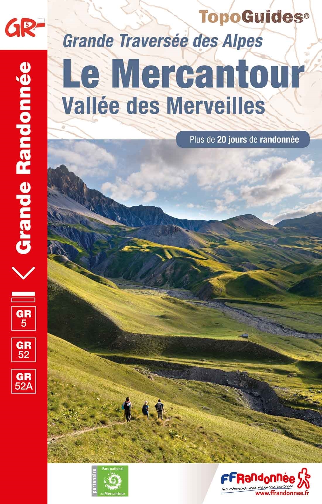
- Le Mercantour - Vallee des Merveilles GR5/GR52/52A
- Le Mercantour: Larche – Nice/Menton, Vallée des Merveilles, FFRP topoguide Ref. No. 507, covering 450km of long-distance routes: the last section of the GR5 in the French Alps from Larche to Nice, an alternative variant off GR5 along the GR52 leading via the Vallée des Merveilles to Menton, plus GR52A – Panoramique du Mecantour from Col du... Leer más
Stanfords
United Kingdom
2020
United Kingdom
2020
- La Traversee der Alpes La Vanoise - PN de la Vanoise GR5/GR55
- 15 days in altitude from the Tarentaise to Modane, heart of the Maurienne. Description also of Via Alpina.La Vanoise (including Parc National de la Vanoise), FFRP topoguide Ref. no. 530, covering the second section of the GR5 in the French Alps between Landry and Modane, its lower variant on the GR5E along the river Arc, plus the traverse of... Leer más
Stanfords
United Kingdom
2021
United Kingdom
2021
- Tour de l`Oisans et des Ecrins - Parc National des Ecrins GR54/GR541
- Tour de l`Oisans et des Ecrins, FFRP topoguide, Ref. No. 508, covering the 11 to 13 days long tour of the Ecrins massif along the GR54, including the local section of the GR5. Variants along GRs 54A, 54B, 54C, and 541 offer less demanding circuits of two to three days. Current edition of this title was published in April 2014.To see other... Leer más

Stanfords
United Kingdom
2019
United Kingdom
2019
- Du Léman à la Vanoise - par le Mont Blanc et le Beaufortain GR5
- The first, 206-km long Alpine section of the GR5 from Lake Geneva, past Mont Blanc and across the Col de la Croix-du-Bonhomme, to Landry north of the Vanoise Massif, FFRP topo-guide ref. no. 504, with colour maps from the IGN TOP25 series at 1:25,000. Also included is a tour of the Dents du Midi. Current edition of this title was published in... Leer más


- Also available from:
- De Zwerver, Netherlands


The Book Depository
United Kingdom
2018
United Kingdom
2018
- The GR5 Trail - Benelux and Lorraine
- The North Sea to Schirmeck in the Vosges mountains Leer más
- Also available from:
- De Zwerver, Netherlands

De Zwerver
Netherlands
2018
Netherlands
2018
- Wandelgids The GR5 Trail Benelux and Lorraine | Cicerone
- Guidebook to walking the northern section of the GR5 - 1000km starting in Hoek van Holland and passing through the Netherlands, Belgium, Luxembourg and Lorraine to Schirmeck in France. A long-distance route covering a variety of cultures and landscapes. The full GR5 from the North Sea to the Mediterranean is one of the world's greatest trails. Leer más

- Also available from:
- De Zwerver, Netherlands
De Zwerver
Netherlands
2021
Netherlands
2021

- Also available from:
- De Zwerver, Netherlands

De Zwerver
Netherlands
2021
Netherlands
2021

Stanfords
United Kingdom
United Kingdom
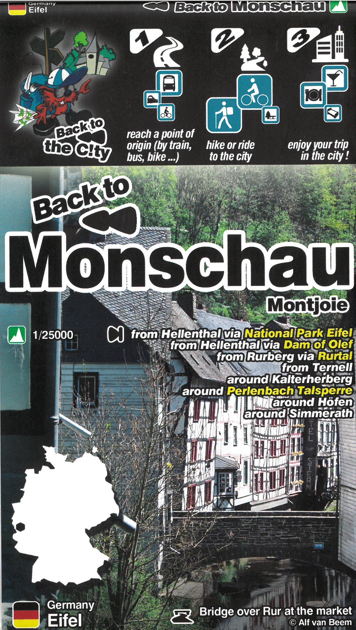
- Monschau Hike & Bike Map
- This new series of hiking / riding maps of regions in the Ardennes, Flanders and various regions in the countries around Belgium are characterized by a clear use of colour and ease of use. With miles of signed small and large loop-shaped walks. - relief and contour lines with an interval of 5 meters - multitude of interesting locations... Leer más
- Also available from:
- De Zwerver, Netherlands
De Zwerver
Netherlands
Netherlands
- Wandelkaart Monschau | Mini-Ardenne
- This new series of hiking / riding maps of regions in the Ardennes, Flanders and various regions in the countries around Belgium are characterized by a clear use of colour and ease of use. With miles of signed small and large loop-shaped walks. - relief and contour lines with an interval of 5 meters - multitude of interesting locations... Leer más
De Zwerver
Netherlands
2022
Netherlands
2022
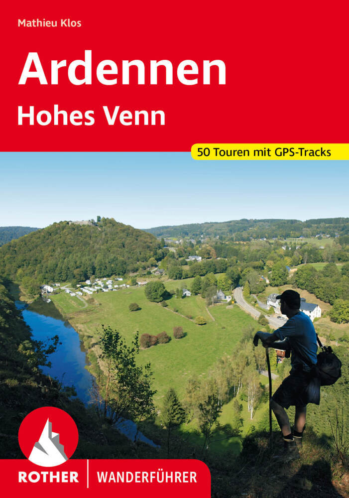
- Wandelgids Ardennen | Rother Bergverlag
- uitstalige wandelgids met zeer goed beschreven wandelingen in de genoemde gebieden. Redelijk kaartmateriaal, vooral de beschrijving van de route en de praktische info die er bij hoort is meer dan goed. Mit den Ardennen und und dem Hohen Venn verfügt Belgien über zwei Mittelgebirge, die noch nahezu unbekannt sind. Die letzten Hochmoore und... Leer más

De Zwerver
Netherlands
2021
Netherlands
2021
Mapas

Stanfords
United Kingdom
United Kingdom
- Autour du Thabor: Modane - Bardonecchia - Briançon
- Mont Thabor area at 1:50,000 on a contoured and GPS compatible map from Editions Didier Richard in their series of walking maps of French Alps and other popular hiking regions of south-eastern France. Coverage extends from Modane in the north to Briançon in the south-east, and west to Valloire.The base map with cartography from the IGN has... Leer más

Stanfords
United Kingdom
United Kingdom
- Ardennes Falkplan Cycling Map 37
- Brussels region and the eastern part of the Flemish Brabant province of Belgium at 1:50,000 in a series from Falk B.V. showing the network of signposted cycling routes on large, double-sided indexed maps with prominent highlighting of long-distance LF routes, symbols indicating accommodation and other tourist services, plus in each title two or... Leer más

Stanfords
United Kingdom
United Kingdom
- Czechia Shocart 50K Tourist Atlas
- Czech Republic Tourist Atlas from Shocart with over 600 pages of contoured mapping at an exceptionally detailed scale of 1:50,000 with hiking and cycling trails, presented in an A4 ring-binder with a hard slipcase. Each page is removable so coverage can be easily assembled for just selected parts of the country, or individual pages used on... Leer más

Stanfords
United Kingdom
2012
United Kingdom
2012
- Eifelsteig Long-distance Trail: Aachen to Trier
- Eifelsteig, a long-distance hiking route from Trier to Aachen across some of the Eifel’s most picturesque towns: Wittlich, Daun, Gerolstein, and Monschau, on a GPS compatible, topographic recreational map at 1:50,000 from the survey organization of Rhineland-Palatinate. The course of the route is presented on three overlapping panels and is... Leer más

Stanfords
United Kingdom
United Kingdom
- Alsace - Mulhouse - Basel - Altkirch K+F Outdoor Map 2
- The southern part of Alsace around Mulhouse and Guebwiller on a GPS compatible, double-sided map at 1:50,000 from Kümmerly+Frey printed on sturdy, waterproof and tear-resistant synthetic paper; contoured, with hiking and cycling routes, sites for other recreational activities, various accommodation options, restaurants and ferme-auberge... Leer más

Stanfords
United Kingdom
United Kingdom
- E3 Arquipelago de Madeira
- Plans included:Porto Santo (1:25 000)Porto de Recreio da Calheta (1:6250)Funchal (1:10 000)Água de Pena (1:5000)Porto de Machico (1:7500)Quinta do Lorde (1:5000)Ponta de São Lourenço (1:30 000)Enseada da Doca (Isla Deserta Grande) (1:25 000)Selvagem Grande (1:30 000)Selvagem Pequena (1:30 000)On this edition the chart specification has been... Leer más

Stanfords
United Kingdom
United Kingdom
- Transrhodopi - Long distance hiking and biking trail From Trigrad to Ivaylovgrad
- Western Rhodope Mountains at 1:100,000 on a contoured GPS compatible map from Domino extending from just west of the Pirin National Park to Asenovgrad in the north-east. The map is double-sided with a good overlap between the sides. Topography is shown by contours at 50m intervals with relief shading and spot heights, plus colouring for... Leer más

Stanfords
United Kingdom
United Kingdom
- Deutsch-Luxemburgischer Nature Park
- Deutsch-Luxemburgischer Nature Park, straddling the border between the southern part of the Eifel in Germany and Luxembourg, on a GPS compatible, topographic recreational map at 1:50,000 from the survey organization of Rhineland-Palatinate with cartography identical to the standard topographic survey of Germany but with additional extensive... Leer más

Stanfords
United Kingdom
United Kingdom
- Luxembourg Kompass 2-Map Set 2202
- Luxembourg and the adjoining areas of the Ardennes in Belgium and the Eifel in Germany at 1:50,000 on a set of two double-sided walking maps from Kompass, Europe’s largest publishers of recreational maps which provide extensive coverage of central Europe, the Alps and other popular hiking regions.Topography is shown by contours at 10m... Leer más

Stanfords
United Kingdom
United Kingdom
- Eifel - Mosel Regional Cycling Map
- Eifel – Mosel on a waterproof, tear-resistant, GPS compatible cycling map at 1:75,000 from the ADFC (Allgemeiner Deutscher Fahrrad-Club - the official German cycling federation), in a series of maps with extensive overprint for long-distance and local cycling routes. GPS waypoints, route profiles, details of online links for information about... Leer más

Stanfords
United Kingdom
United Kingdom
- Lower Moselle - Cochem to Koblenz - Mayen - Burg Eitz K+F Outdoor Map 21
- The Lower Moselle Valley between Cochem and Koblenz at 1:35,000 from Kümmerly+Frey in a series GPS compatible, double-sided maps printed on durable, waterproof and tear-resistant plastic paper; contoured, with hiking and cycle routes, other recreational activities, etc.Maps in this series are at a scale of either 1:50,000 or 1:35,000. Contour... Leer más

Stanfords
United Kingdom
United Kingdom
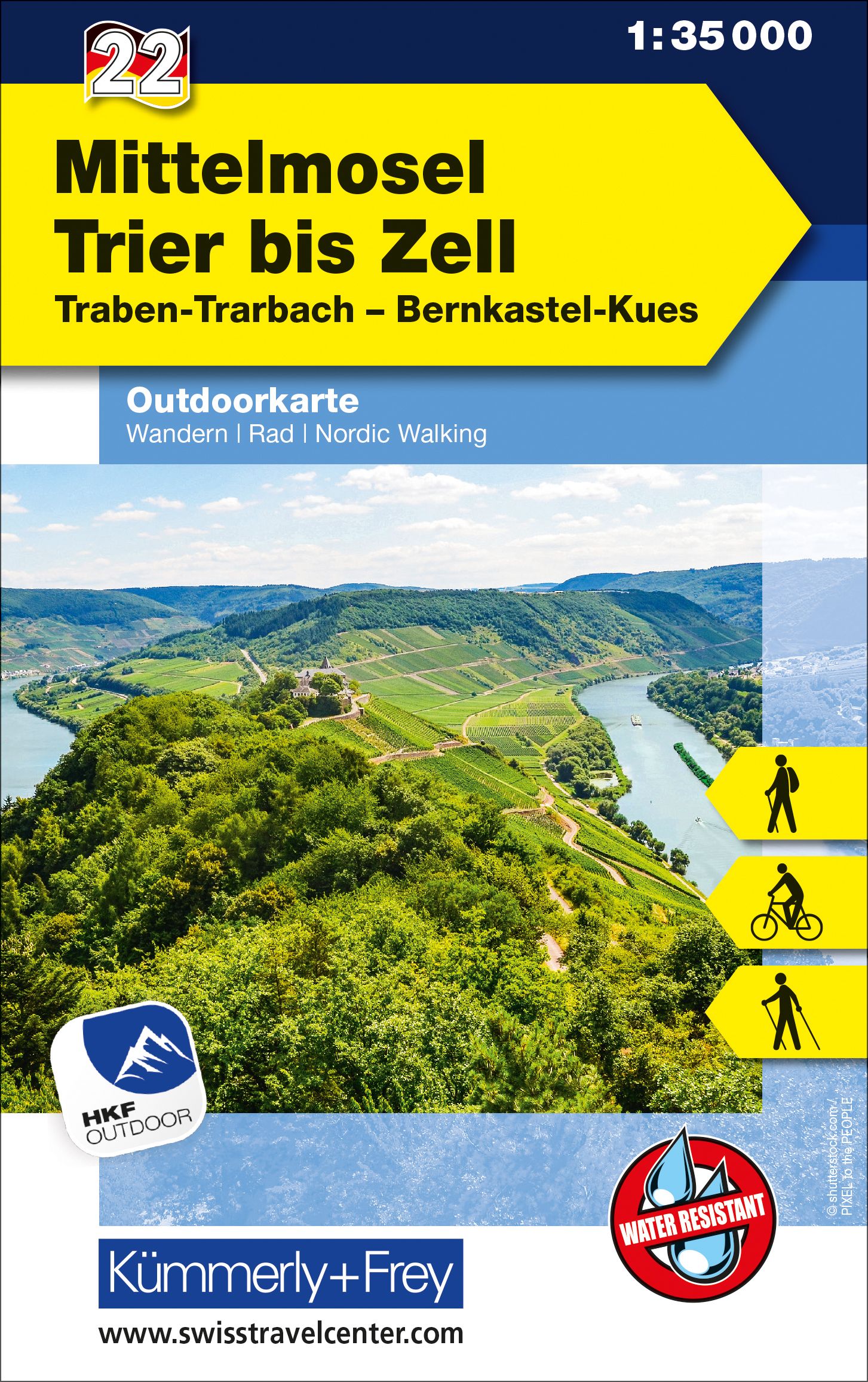
- Central Moselle Valley - Trier to Zell K+F Outdoor Map 22
- The central Moselle Valley between Trier and Zell at 1:35,000 from Kümmerly+Frey in a series GPS compatible, double-sided maps printed on durable, waterproof and tear-resistant plastic paper; contoured, with hiking and cycle routes, other recreational activities, etc.Maps in this series are at a scale of either 1:50,000 or 1:35,000. Contour... Leer más

Stanfords
United Kingdom
United Kingdom
- Malmédy NGI Topo 50-50A
- Topographical survey of Belgium at 1:50,000 from the country’s national survey organization, Nationaal Geografisch Instituut / Institut Géographique National. Contour interval varies according to the terrain, from 2.5 metres in the coastal areas to 10 metres in the Ardennes. The maps provide all the information expected of topographic mapping... Leer más
Stanfords
United Kingdom
United Kingdom
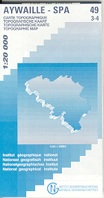
- Aywaille - Spa NGI Belgium Survey Map No. 49/3-4
- Topographical survey of Belgium at 1:20,000 from Nationaal Geografisch Instituut / Institut Géographique National, the country’s national survey organization. Each 20K map covers one quarter of the corresponding 1:50,000 map (with adjustments in the border and coastal areas). The maps provide all the information expected of topographic mapping... Leer más

Stanfords
United Kingdom
2022
United Kingdom
2022
- Eifelsteig long-distance Trail Kompass 2502
- The Eifelsteig, a 310km long-distance hiking trail from Kornelimünster near Aachen to Trier, crossing some of the most picturesque towns of the Eifel, including Monschau, Blankenheim, Gerolstein and Daun. The route is presented on 18 panels, accompanied by street plans of Kornelimünster, Monschau, Gerolstein and Trier.Maps in this new series... Leer más