
Ardennes
Descripción
Mapa

Senderos en región
- Alzette PathGPX
- Attert PathGPX
- Charles Mathieu PathGPX
- Clervaux - Our
- E2GPX
- E3GPX
- Eisléck PathGPX
- Fred Welter Path
- GR122 - ScheldelandGPX
- GR125 - Tour de l'Entre-Sambre-et-MeuseGPX
- GR126 - Brussel-Namen-Membre sur SamoisGPX
- GR14 - Sentier de l'ArdenneGPX
- GR15 - AE - Ardennes-EifelGPX
- GR5GPX
- GR56 - Hautes Fagnes - EifelGPX
- GR57 - Vallée de l'OurtheGPX
- GR570 - Pays des Trois FrontièresGPX
- GR571 - Vallées des LégendesGPX
- GR575 - Tour du Condroz NamuroisGPX
- GR576 - Tour du Condroz LiégeoisGPX
- GR577 - Tour de la FamenneGPX
- GR579 - Brussels - LiègeGPX
- Little Switzerland PathGPX
- Lower-Sûre Path
- Mamer PathGPX
- Maurice Cosyn PathGPX
- Mëllerdall Path
- Müllerthal TrailGPX
- Moselle PathGPX
- North PathGPX
- Our PathGPX
- Panorama PathGPX
- Path of the MineworkersGPX
- Préizerdaul PathGPX
- Remerschen - HellangeGPX
- Rhine-Meuse Trail
- Schengen – Hellange
- South LuxembourgGPX
- South PathGPX
- Tour de la Vesdre
- Transardense Route
- Upper-Sûre Lake PathGPX
- Upper-Sûre PathGPX
- Valley of the 7 CastlesGPX
- Victor Hugo PathGPX
- Wiltz PathGPX
Enlaces
Datos
Informes
Guías y mapas
Hospedaje
Organizaciones
Operadores turísticos
GPS
Otro
Libros

Stanfords
United Kingdom
United Kingdom
- Dinant Hike & Bike Map
- This new series of hiking / riding maps of regions in the Ardennes, Flanders and various regions in the countries around Belgium are characterized by a clear use of colour and ease of use. With miles of signed small and large loop-shaped walks. - relief and contour lines with an interval of 5 meters - multitude of interesting locations... Leer más

Stanfords
United Kingdom
United Kingdom
- Viroinval Hike & Bike Map
- This new series of hiking / riding maps of regions in the Ardennes, Flanders and various regions in the countries around Belgium are characterized by a clear use of colour and ease of use. With miles of signed small and large loop-shaped walks. - relief and contour lines with an interval of 5 meters - multitude of interesting locations... Leer más

Stanfords
United Kingdom
United Kingdom
- Cap Gris Nez Hike & Bike Map
- This new series of hiking and riding maps of various regions are characterized by a clear use of colour and ease of use. With miles of signed small and large loop-shaped walks.- relief and contour lines with an interval of 5 meters - multitude of interesting locations (restaurants, hotels, holiday homes, bakers, butchers, eateries, pharmacists,... Leer más

Stanfords
United Kingdom
2017
United Kingdom
2017
- Les Ardennes à pied D008
- Les Ardennes à pied, FFRP topo-guide Ref. No. D008, with 47 day walks of varying length and difficulty in the Department of Ardennes, mainly in the area north of Charleville-Mézières around Rocroi, Fumay and Givet, and around Sedan. Each walk is presented on a separate colour extract from IGN’s topographic survey of France at 1:25,000 and/or... Leer más

Stanfords
United Kingdom
United Kingdom
- Titisee Hike & Bike Map
- This new series of hiking / riding maps of regions in the Ardennes, Flanders and various regions in the countries around Belgium are characterized by a clear use of colour and ease of use. With miles of signed small and large loop-shaped walks. - relief and contour lines with an interval of 5 meters - multitude of interesting locations... Leer más

Stanfords
United Kingdom
United Kingdom
- Ribeauville Hike & Bike Map
- This new series of hiking and riding maps of various regions are characterized by a clear use of colour and ease of use. With miles of signed small and large loop-shaped walks.- relief and contour lines with an interval of 5 meters - multitude of interesting locations (restaurants, hotels, holiday homes, bakers, butchers, eateries, pharmacists,... Leer más

Stanfords
United Kingdom
United Kingdom
- Cochem Hike & Bike Map
- This new series of hiking / riding maps of regions in the Ardennes, Flanders and various regions in the countries around Belgium are characterized by a clear use of colour and ease of use. With miles of signed small and large loop-shaped walks. - relief and contour lines with an interval of 5 meters - multitude of interesting locations... Leer más

Stanfords
United Kingdom
United Kingdom
- Gerardmer Hike & Bike Map
- This new series of hiking and riding maps of various regions are characterized by a clear use of colour and ease of use. With miles of signed small and large loop-shaped walks.- relief and contour lines with an interval of 5 meters - multitude of interesting locations (restaurants, hotels, holiday homes, bakers, butchers, eateries, pharmacists,... Leer más

Stanfords
United Kingdom
United Kingdom
- Louvain-la-Neuve Hike & Bike Map
- This new series of hiking / riding maps of regions in the Ardennes, Flanders and various regions in the countries around Belgium are characterized by a clear use of colour and ease of use. With miles of signed small and large loop-shaped walks. - relief and contour lines with an interval of 5 meters - multitude of interesting locations... Leer más

Stanfords
United Kingdom
United Kingdom
- De Panne Hike & Bike Map
- This new series of hiking / riding maps of regions in the Ardennes, Flanders and various regions in the countries around Belgium are characterized by a clear use of colour and ease of use. With miles of signed small and large loop-shaped walks. - relief and contour lines with an interval of 5 meters - multitude of interesting locations... Leer más

Stanfords
United Kingdom
United Kingdom
- North York Moors Western OS Explorer Active Map OL26 (waterproof)
- The western part of the North York Moors National Park on a detailed topographic and GPS compatible map OL26, waterproof version, from the Ordnance Survey’s 1:25,000 Explorer series. Coverage extends from Ampleforth in the south northwards to Saltburn-by-the-Sea, and from Ingleby Arncliffe to Danby, Castleton and Hutton-le-Hole, and includes... Leer más


- Also available from:
- De Zwerver, Netherlands


- Also available from:
- De Zwerver, Netherlands

Más libros…

Mapas

Stanfords
United Kingdom
United Kingdom
- Eupen Mini-Ardenne
- Ardennes Recreational Maps at a scale of 1:25,000 enable you to discover the Ardennes from junction to junction, each associated with a locality, through a network of hiking, cycling or riding paths. The network of mini walks consists of suggested routes with kilometre distance marked showing field boundaries and urbanised built up areas.... Leer más

Stanfords
United Kingdom
United Kingdom
- Mullerthal Hike & Bike Map
- This new series of hiking / riding maps of regions in the Ardennes, Flanders and various regions in the countries around Belgium are characterized by a clear use of colour and ease of use. With miles of signed small and large loop-shaped walks. - relief and contour lines with an interval of 5 meters - multitude of interesting locations... Leer más

Stanfords
United Kingdom
United Kingdom
- Luxembourg North
- One of two topographic survey maps of Luxembourg at 1:50,000, with contours at 10-metres intervals and additional relief shading. An overprint highlights long-distance footpaths, including the GR5 (E-2), cycle routes, and various places of interest, including campsites. The map covers an area of approximately 53 x 43 km / 33 x 27 miles. Map... Leer más
Stanfords
United Kingdom
United Kingdom
- Ans - Liège 20K NGI Belgium Survey Map No. 42/1-2
- Topographical survey of Belgium at 1:20,000 from Nationaal Geografisch Instituut / Institut Géographique National, the country’s national survey organization. Each 20K map covers one quarter of the corresponding 1:50,000 map (with adjustments in the border and coastal areas). The maps provide all the information expected of topographic mapping... Leer más
Stanfords
United Kingdom
United Kingdom
- Welkenraedt - Kelmis (La Calamine)
- Topographical survey of Belgium at 1:20,000 from Nationaal Geografisch Instituut / Institut Géographique National, the country’s national survey organization. Each 20K map covers one quarter of the corresponding 1:50,000 map (with adjustments in the border and coastal areas). The maps provide all the information expected of topographic mapping... Leer más

Stanfords
United Kingdom
United Kingdom
- Gesves - Ohey
- Topographical survey of Belgium at 1:20,000 from Nationaal Geografisch Instituut / Institut Géographique National, the country’s national survey organization. Each 20K map covers one quarter of the corresponding 1:50,000 map (with adjustments in the border and coastal areas). The maps provide all the information expected of topographic mapping... Leer más

Stanfords
United Kingdom
United Kingdom
- Luxembourg South
- One of two topographic survey maps of Luxembourg at 1:50,000, with contours at 10-metres intervals and additional relief shading. An overprint highlights long-distance footpaths, including the GR5 (E-2), cycle routes, and various places of interest, including campsites. The map covers an area of approximately 53 x 43 km / 33 x 27 miles. Map... Leer más

Stanfords
United Kingdom
United Kingdom
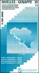
- Nivelles - Genappe: Battle of Waterloo Area 20K NGI Belgium Survey Map No. 39/7-8
- Nivelles - Genappe, map No. 39/7-8 in the topographic survey of Belgium at 1:20,000 covering an area east of the town of Nivelles including Les Quatre Bras, the site of French victory on 16th June 1815, two days before the Battle of Waterloo.Although not specifically designed to highlight locations connected with the Battle of Waterloo, the map... Leer más

Stanfords
United Kingdom
United Kingdom
- Dalhem - Herve
- Topographical survey of Belgium at 1:20,000 from Nationaal Geografisch Instituut / Institut Géographique National, the country’s national survey organization. Each 20K map covers one quarter of the corresponding 1:50,000 map (with adjustments in the border and coastal areas). The maps provide all the information expected of topographic mapping... Leer más

Stanfords
United Kingdom
United Kingdom
- Limbourg - Eupen 20K NGI Belgium Survey Map No. 43/5-6
- Topographical survey of Belgium at 1:20,000 from Nationaal Geografisch Instituut / Institut Géographique National, the country’s national survey organization. Each 20K map covers one quarter of the corresponding 1:50,000 map (with adjustments in the border and coastal areas). The maps provide all the information expected of topographic mapping... Leer más
Stanfords
United Kingdom
United Kingdom
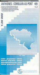
- Anthisnes - Comblain-au-Pont
- Topographical survey of Belgium at 1:20,000 from Nationaal Geografisch Instituut / Institut Géographique National, the country’s national survey organization. Each 20K map covers one quarter of the corresponding 1:50,000 map (with adjustments in the border and coastal areas). The maps provide all the information expected of topographic mapping... Leer más

Stanfords
United Kingdom
United Kingdom
- Seraing - Chaudfontaine
- Topographical survey of Belgium at 1:20,000 from Nationaal Geografisch Instituut / Institut Géographique National, the country’s national survey organization. Each 20K map covers one quarter of the corresponding 1:50,000 map (with adjustments in the border and coastal areas). The maps provide all the information expected of topographic mapping... Leer más
Stanfords
United Kingdom
United Kingdom
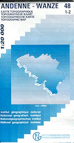
- Andenne - Wanze
- Topographical survey of Belgium at 1:20,000 from Nationaal Geografisch Instituut / Institut Géographique National, the country’s national survey organization. Each 20K map covers one quarter of the corresponding 1:50,000 map (with adjustments in the border and coastal areas). The maps provide all the information expected of topographic mapping... Leer más

Stanfords
United Kingdom
United Kingdom
- Ouren
- Topographical survey of Belgium at 1:20,000 from Nationaal Geografisch Instituut / Institut Géographique National, the country’s national survey organization. Each 20K map covers one quarter of the corresponding 1:50,000 map (with adjustments in the border and coastal areas). The maps provide all the information expected of topographic mapping... Leer más
Stanfords
United Kingdom
United Kingdom
- Fleron - Verviers
- Topographical survey of Belgium at 1:20,000 from Nationaal Geografisch Instituut / Institut Géographique National, the country’s national survey organization. Each 20K map covers one quarter of the corresponding 1:50,000 map (with adjustments in the border and coastal areas). The maps provide all the information expected of topographic mapping... Leer más