Granatspitzgruppe
Descripción
Central mountain in this mountain range (not the heighest) is the Granatspitze, 3.086m. This mountain group is part of the Hohe Tauern, squeezed in between two more famous ranges: the Venedigergruppe and the Glocknergruppe. The advantage of this range is that you will actually see the Grossglockner and Grossvenediger, especially takeing the Sudetendeutscher Höhenweg, a ridge-walk from the Kals-Matreier Törlhaus (note: this is not a stroll but a serious mountain route). Another detail: many Austria lovers will know the Rudolfshütte, once the trainings centre of the ÖAV. Well, this hut is located in this Granatspitz range!
Senderos en región
Enlaces
Datos
Informes
Guías y mapas
Hospedaje
Organizaciones
Operadores turísticos
GPS
Otro
Libros
Bol.com
Netherlands
Netherlands
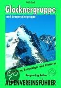
- Glockner- Und Granatspitzgruppe
- Der Großglockner, Primus inter pares im Land der Berge, übt seit jeher auf Alpinisten aller Herren Länder eine ungebrochen magische Anziehungskraft aus. Und in der Tat bieten seine Grate, Flanken und Wände immer noch Traumziele und Höhepunkte eines Bergsteigerlebens und brauchen einen Vergleich mit westalpinen Größen wie Jungfrau, Matterhorn... Leer más
- Also available from:
- Bol.com, Belgium
Bol.com
Belgium
Belgium
- Glockner- Und Granatspitzgruppe
- Der Großglockner, Primus inter pares im Land der Berge, übt seit jeher auf Alpinisten aller Herren Länder eine ungebrochen magische Anziehungskraft aus. Und in der Tat bieten seine Grate, Flanken und Wände immer noch Traumziele und Höhepunkte eines Bergsteigerlebens und brauchen einen Vergleich mit westalpinen Größen wie Jungfrau, Matterhorn... Leer más

De Zwerver
Netherlands
2016
Netherlands
2016
- Wandelgids Tauern-Höhenweg | Rother Bergverlag
- Uitstekende beschrijvingen van deze steeds populairder wordende bergtocht! Met alle noodzakelijke info. Zie voor beschrijving de duitse tekst hieronder ..... Nicht nur im Bann von Großglockner und Großvenediger erstreckt sich auf einer Gesamtlänge von etwa 200 Kilometern der Tauern-Höhenweg, der alle Gebirgsgruppen der Niederen und Hohen Tauern... Leer más

De Zwerver
Netherlands
2008
Netherlands
2008
- Wandelgids Arnoweg - Der Salzburger Rundwanderweg | Rother Bergverlag
- Dieser gemeinsam mit dem Tourismusverband SalzburgerLand herausgegebene Wanderführer beschreibt detailliert alle Etappen des erst 1999 aus der Taufe gehobenen Arnowegs. Anlaß für die Errichtung dieses Weitwanderwegs war das 1200jährige Jubiläum der Erzdiözese Salzburg, 798 nämlich wurde Bischof Arno zum Erzbischof dieser großen Kirchenprovinz... Leer más
Mapas

Stanfords
United Kingdom
United Kingdom
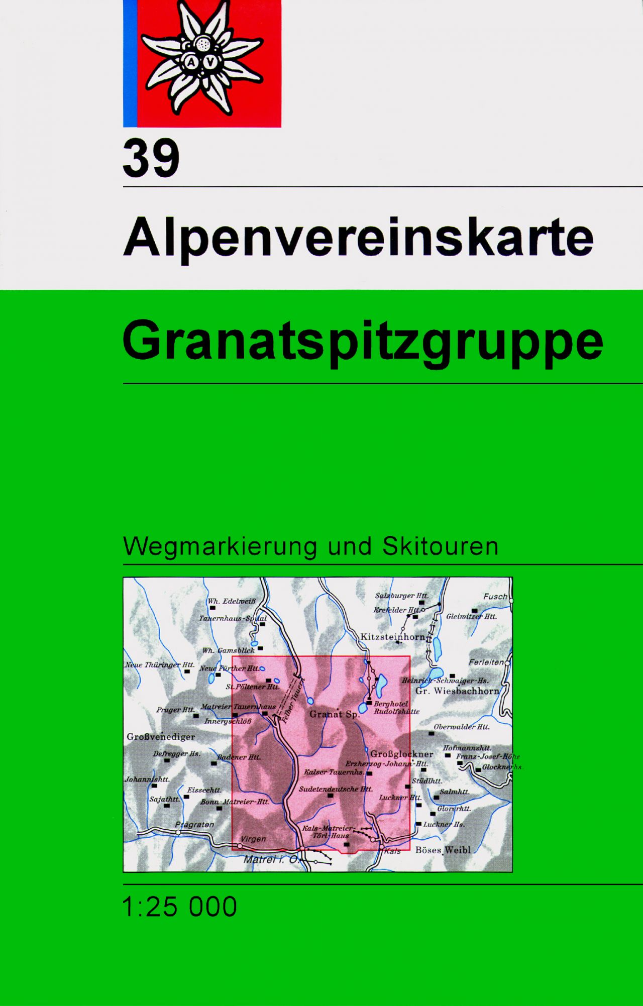
- Granatspitzgruppe Alpenverein KOMBI Map 39
- Granatspitzgruppe area of the Alps in a combined hiking and ski edition at 1:25,000 from a series of detailed, GPS compatible maps published by the DAV - Deutscher Alpenverein and produced by the German and Austrian Alpine Clubs using cartography from their respective survey organizations. Maps in this series have topography vividly presented... Leer más

Stanfords
United Kingdom
United Kingdom
- Grossvenediger - Oberpinzgau F&B WK121
- Grossvenediger - Oberpinzgau area of the Austrian Alps presented at 1:50,000 in a series of contoured and GPS compatible outdoor leisure map from Freytag & Berndt with hiking and cycling routes, mountain huts, campsites and youth hostels, local bus stops, plus other tourist information.To see the list of currently available titles in this... Leer más
- Also available from:
- The Book Depository, United Kingdom

The Book Depository
United Kingdom
United Kingdom
- Grossvenediger - Oberpinzgau Hiking + Leisure Map 1:50 000
- Grossvenediger - Oberpinzgau area of the Austrian Alps presented at 1:50,000 in a series of contoured and GPS compatible outdoor leisure map from Freytag & Berndt with hiking and cycling routes, mountain huts, campsites and youth hostels, local bus stops, plus other tourist information.To see the list of currently available titles in this... Leer más

Stanfords
United Kingdom
United Kingdom
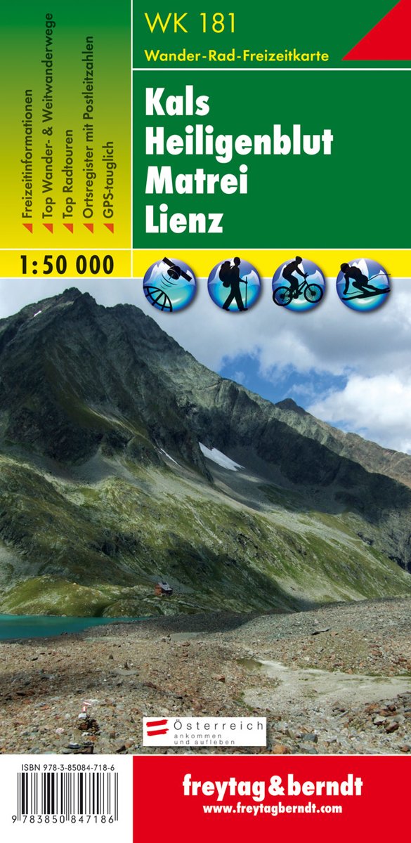
- Kals - Heiligenblut - Matrei - Lienz F&B WK181
- Kals - Heiligenblut - Matrei - Lienz area of the Austrian Alps presented at 1:50,000 in a series of contoured and GPS compatible outdoor leisure map from Freytag & Berndt with hiking and cycling routes, mountain huts, campsites and youth hostels, local bus stops, plus other tourist information.To see the list of currently available titles in... Leer más
- Also available from:
- The Book Depository, United Kingdom
- Bol.com, Netherlands
- Bol.com, Belgium

The Book Depository
United Kingdom
United Kingdom
- Kals - Heiligenblut - Matrei - Lienz Hiking + Leisure Map 1:50 000
- Kals - Heiligenblut - Matrei - Lienz area of the Austrian Alps presented at 1:50,000 in a series of contoured and GPS compatible outdoor leisure map from Freytag & Berndt with hiking and cycling routes, mountain huts, campsites and youth hostels, local bus stops, plus other tourist information.To see the list of currently available titles in... Leer más
Bol.com
Netherlands
Netherlands
- FB WK181 Kals • Heiligenblut • Matrei • Lienz
- Fiets- en wandelkaart • schaal 1:50 000 • activiteiten gids • plaatsnamenregister met postcodes • fietspaden en mountainbikeroutes • vermelding GPS-punten • met ski- en langlaufroutes Leer más
Bol.com
Belgium
Belgium
- FB WK181 Kals • Heiligenblut • Matrei • Lienz
- Fiets- en wandelkaart • schaal 1:50 000 • activiteiten gids • plaatsnamenregister met postcodes • fietspaden en mountainbikeroutes • vermelding GPS-punten • met ski- en langlaufroutes Leer más

Stanfords
United Kingdom
United Kingdom
- Bregenz Forest F&B WK364
- Bregenz - Bregenzerwald area of the Austrian Alps presented at 1:50,000 in a series of contoured and GPS compatible outdoor leisure map from Freytag & Berndt with hiking and cycling routes, mountain huts, campsites and youth hostels, local bus stops, plus other tourist information. To see the list of currently available titles in this series... Leer más
- Also available from:
- The Book Depository, United Kingdom
- Bol.com, Netherlands
- Bol.com, Belgium

The Book Depository
United Kingdom
United Kingdom
- Bregenz Forest Hiking + Leisure Map 1:50 000
- Bregenz - Bregenzerwald area of the Austrian Alps presented at 1:50,000 in a series of contoured and GPS compatible outdoor leisure map from Freytag & Berndt with hiking and cycling routes, mountain huts, campsites and youth hostels, local bus stops, plus other tourist information. To see the list of currently available titles in this series... Leer más

Bol.com
Netherlands
Netherlands
- FB WK364 Bregenzerwald
- Aufgrund der übersichtlichen und detailgetreuen, digitalen Kartographie sowie der ideal gewählten Maßstäbe sind freytag & berndt Wanderkarten der perfekte Begleiter beim Wandern und Bergsteigen. Sie werden regelmäßig überarbeitet und enthalten aktualisierte Informationen zu Wanderwegen, Rad- und Mountainbikestrecken, Hütten, Naturdenkmälern,... Leer más
Bol.com
Belgium
Belgium
- FB WK364 Bregenzerwald
- Aufgrund der übersichtlichen und detailgetreuen, digitalen Kartographie sowie der ideal gewählten Maßstäbe sind freytag & berndt Wanderkarten der perfekte Begleiter beim Wandern und Bergsteigen. Sie werden regelmäßig überarbeitet und enthalten aktualisierte Informationen zu Wanderwegen, Rad- und Mountainbikestrecken, Hütten, Naturdenkmälern,... Leer más
Más mapas…