
Chiemgauer Alpen
Descripción

This area, part of the Northern Limestone Alps, belongs more or less to the same mountain group as the better known Berchtesgadener Alps. They are situated between Salzburg and the Inn valley, mostly on German territory.
We'd better characterize them as pre-Alps, since they do not offer the high altitude of the Berchtesgadener Alps. The highest summit is the Sonntagshorn (1.960 m).
Nevertheless, as everywhere in the German Alps, you may expect fine walking possibilities in these forests and alms, accentuated by the rocky limestone massifs sticking out of them.
Mapa


Senderos en región
Enlaces
Datos
Informes
Guías y mapas
Hospedaje
Organizaciones
Operadores turísticos
GPS
Otro
Libros

Stanfords
United Kingdom
2018
United Kingdom
2018
- Walking in the Bavarian Alps
- A comprehensive guidebook detailing walks in Germany`s Bavarian Alps. Lying along the German-Austrian border in a thin sliver of land roughly 300km long, this area contains some of the most spectacular walking and beautiful scenery that Germany has to offer. 70 graded walks explore mountain landscapes, wild mountain gorges and alpine meadows as... Leer más
- Also available from:
- The Book Depository, United Kingdom
- De Zwerver, Netherlands

The Book Depository
United Kingdom
2018
United Kingdom
2018
- Walking in the Bavarian Alps
- 70 mountain walks and treks in southern Germany Leer más

De Zwerver
Netherlands
2018
Netherlands
2018
- Wandelgids Beieren - Walking in the Bavarian Alps | Cicerone
- Guidebook to mountain walks and treks in the Bavarian Alps, on the border of Germany and Austria, between Lake Constance and Berchtesgaden. Accessible from Munich, Salzburg and Innsbruck, these 70 routes range from half-day walks to 3-day hut-to-hut treks. Highlights include the Königssee and Breitach, Partnach and Höllental gorges. Leer más

Bol.com
Netherlands
Netherlands
- Berlin, Potsdam, Oranienberg & Beyond
- We travel to grow -- our Adventure Guides show you how. Experience the places you visit more directly, freshly, intensely than you would otherwise -- sometimes best done on foot, in a canoe, or through cultural adventures like art courses, cooking classes, learning the language, meeting the people, joining in the festivals and celebrations.... Leer más
- Also available from:
- Bol.com, Belgium
Bol.com
Belgium
Belgium
- Berlin, Potsdam, Oranienberg & Beyond
- We travel to grow -- our Adventure Guides show you how. Experience the places you visit more directly, freshly, intensely than you would otherwise -- sometimes best done on foot, in a canoe, or through cultural adventures like art courses, cooking classes, learning the language, meeting the people, joining in the festivals and celebrations.... Leer más

De Zwerver
Netherlands
2023
Netherlands
2023
De Zwerver
Netherlands
2016
Netherlands
2016
- Wandelgids Berchtesgadener und Chiemgauer Wanderberge 50 Touren zwischen Inn und Salzach | Rother Bergverlag
- De ‘Rother Wanderbücher’ behandelen telkens de 50 mooiste wandelingen, die variëren van eenvoudige kindvriendelijke wandelingen tot routes die aanzienlijk meer ervaring vereisen. Uitvoerige routebeschrijvingen, een aantrekkelijke lay-out met vele kleurenfoto’s, niets aan duidelijkheid te wensen gelaten hoogteprofielen, kaartjes met de... Leer más

Bol.com
Netherlands
Netherlands
- WF5421 Allgäu, Allgäuer Alpen Kompass
- De Kompass wandelgids + kaart geeft een overzicht van alle wandelroutes in het gebied met nauwkeurige routeaanwijzingen en hoogteaanduidingen, De extra grote kaart, schaal 1:35 000, is ideaal om van te voren uw route uit te stippelen en om onderweg te gebruiken • naast de bekende bestemmingen, worden ook de minder bekende vermeld • openbaar... Leer más
- Also available from:
- Bol.com, Belgium
Bol.com
Belgium
Belgium
- WF5421 Allgäu, Allgäuer Alpen Kompass
- De Kompass wandelgids + kaart geeft een overzicht van alle wandelroutes in het gebied met nauwkeurige routeaanwijzingen en hoogteaanduidingen, De extra grote kaart, schaal 1:35 000, is ideaal om van te voren uw route uit te stippelen en om onderweg te gebruiken • naast de bekende bestemmingen, worden ook de minder bekende vermeld • openbaar... Leer más

Bol.com
Netherlands
2017
Netherlands
2017
- Griechenland: Trans Kreta E4
- Kein Geheimtipp und dennoch etwas in Vergessenheit geraten ist das ber 500 km lange Teilst ck des europ ischen Fernwanderweges E4 auf Kreta. Bereits seit den 1970er-Jahren geh rt dieser Abschnitt zu einem der beliebtesten des l ngsten europ ischen Fernwanderweges und ist somit ein echter Trekkingklassiker.Wer gut markierte Pfade und verl... Leer más
- Also available from:
- Bol.com, Belgium
- De Zwerver, Netherlands
Bol.com
Belgium
2017
Belgium
2017
- Griechenland: Trans Kreta E4
- Kein Geheimtipp und dennoch etwas in Vergessenheit geraten ist das ber 500 km lange Teilst ck des europ ischen Fernwanderweges E4 auf Kreta. Bereits seit den 1970er-Jahren geh rt dieser Abschnitt zu einem der beliebtesten des l ngsten europ ischen Fernwanderweges und ist somit ein echter Trekkingklassiker.Wer gut markierte Pfade und verl... Leer más

De Zwerver
Netherlands
2017
Netherlands
2017
- Wandelgids E4 Kreta Lefka Ori und Lasithi | Conrad Stein Verlag
- OutdoorHandbuch. 3. Auflage. Leer más

Stanfords
United Kingdom
2015
United Kingdom
2015
- Crete High Mountain Walks, the White Mountains, Mt Ida and Lassithi - 3rd ed.
- The High Mountains of Crete is Loraine Wilson’s authoritative Cicerone guide to the best walking routes in Crete’s mountainous regions. The guide covers walks in the well-known Samaria Gorge and the other dramatic gorges and numerous peaks rising to over 2100m, alongside high mountain plains, forested crags, massive cliffs and remote beaches.... Leer más
- Also available from:
- The Book Depository, United Kingdom
- Bol.com, Netherlands
- Bol.com, Belgium
- De Zwerver, Netherlands

The Book Depository
United Kingdom
2015
United Kingdom
2015
- The High Mountains of Crete
- The White Mountains, Psiloritis and Lassithi Mountains Leer más

Bol.com
Netherlands
2015
Netherlands
2015
- The high mountains of Crete
- Guidebook to walking and trekking the high mountains of Crete. The largest of the Greek Islands, Crete's mountains provide breathtaking walking and wilderness on this popular island. The routes in this guidebook are graded for difficulty and range from short, easy strolls to challenging, multi-day treks, providing options for all walkers. In... Leer más
Bol.com
Belgium
2015
Belgium
2015
- The high mountains of Crete
- Guidebook to walking and trekking the high mountains of Crete. The largest of the Greek Islands, Crete's mountains provide breathtaking walking and wilderness on this popular island. The routes in this guidebook are graded for difficulty and range from short, easy strolls to challenging, multi-day treks, providing options for all walkers. In... Leer más

De Zwerver
Netherlands
2015
Netherlands
2015
- Wandelgids The high mountains of Crete - Kreta | Cicerone
- Guidebook of walking routes in Crete's mountains, covering the Lefka Ori (White Mountains), Mount Ida (the Psiloritis range), the Lassithi mountains and E4 trail. Each of the 87 walks is graded, in a range between 2 and 28km with various longer options, covering a multitude of terrains from rugged mountain ridges to forested crags and beaches. Leer más
Bol.com
Netherlands
Netherlands
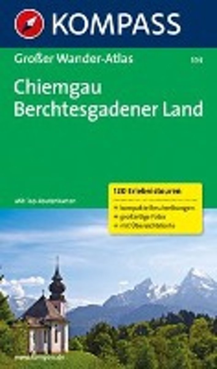
- Kompass WA594 Chiemgau, Berchtesgadenerland
- Die KOMPASS Wander-Atlanten überzeugen durch: ausgewogene Tourenwahl für jede Kondition, mindestens 100 Tourenvorschläge,In deze Duitstalige Kompass wandelatlas vindt u de 120 mooiste wandelingen in het gebied • Routes voor zowel getrainde als ongetrainde wandelaars • gedetailleerde kaarten • duidelijke routebeschrijvingen met fraaie foto's •... Leer más
- Also available from:
- Bol.com, Belgium
Bol.com
Belgium
Belgium
- Kompass WA594 Chiemgau, Berchtesgadenerland
- Die KOMPASS Wander-Atlanten überzeugen durch: ausgewogene Tourenwahl für jede Kondition, mindestens 100 Tourenvorschläge,In deze Duitstalige Kompass wandelatlas vindt u de 120 mooiste wandelingen in het gebied • Routes voor zowel getrainde als ongetrainde wandelaars • gedetailleerde kaarten • duidelijke routebeschrijvingen met fraaie foto's •... Leer más

Bol.com
Netherlands
2014
Netherlands
2014
- Walking in the Bavarian Alps
- Guidebook describing a both valley and mountain walks and treks in the Bavarian Alps. 85 walks are covered, including graded mountain routes, gentler valley walks, hut-to-hut routes and two multi-day tours, arranged by region with practical information on transport, accommodation and the like. Since the last edition of this guide many of the... Leer más
- Also available from:
- Bol.com, Belgium
Bol.com
Belgium
2014
Belgium
2014
- Walking in the Bavarian Alps
- Guidebook describing a both valley and mountain walks and treks in the Bavarian Alps. 85 walks are covered, including graded mountain routes, gentler valley walks, hut-to-hut routes and two multi-day tours, arranged by region with practical information on transport, accommodation and the like. Since the last edition of this guide many of the... Leer más

Bol.com
Netherlands
Netherlands
- Wanderland Schweiz 02. Trans Swiss Trail
- Das Wanderland Schweiz besteht aus 6 nationalen Routen und 51 mehrtägigenHighlights. Die Routen basieren auf dem bestehenden Wanderwegnetz und integrierenteilweise bereits bestehende Angebote wie beispielsweise Via Alpina, Jura Höhenweg,Via Jacobi oder Rheintaler Höhenweg.Alle 9 Führer sind mit Farbfotos, Karten und Höhenprofilen farbig reich... Leer más
- Also available from:
- Bol.com, Belgium
Bol.com
Belgium
Belgium
- Wanderland Schweiz 02. Trans Swiss Trail
- Das Wanderland Schweiz besteht aus 6 nationalen Routen und 51 mehrtägigenHighlights. Die Routen basieren auf dem bestehenden Wanderwegnetz und integrierenteilweise bereits bestehende Angebote wie beispielsweise Via Alpina, Jura Höhenweg,Via Jacobi oder Rheintaler Höhenweg.Alle 9 Führer sind mit Farbfotos, Karten und Höhenprofilen farbig reich... Leer más

Bol.com
Netherlands
Netherlands
- Over the Top & Back Again
- Book of the Year Bronze Award 2010 (travel essays category), ForeWord Magazine After hiking some of the world's great trails, Brandon Wilson was excited to hear about the Via Alpina, paths running across eight countries on the backbone of the Alps. Besides promising immersion into Alpine life and wilderness, it was the ultimate adventure. It... Leer más
- Also available from:
- Bol.com, Belgium
Bol.com
Belgium
Belgium
- Over the Top & Back Again
- Book of the Year Bronze Award 2010 (travel essays category), ForeWord Magazine After hiking some of the world's great trails, Brandon Wilson was excited to hear about the Via Alpina, paths running across eight countries on the backbone of the Alps. Besides promising immersion into Alpine life and wilderness, it was the ultimate adventure. It... Leer más
De Zwerver
Netherlands
2023
Netherlands
2023
Mapas

Stanfords
United Kingdom
United Kingdom
- Goms - Aletsch
- Goms - Aletsch area of the Bernese Oberland at 1:50,000 in a series from Hallwag covering Switzerland’s popular hiking regions on light, waterproof and tear-resistant maps highlighting long-distance paths: the nine national routes plus special regional routes, as well as other local hiking trails.Cartography is similar to that used both in... Leer más

Stanfords
United Kingdom
United Kingdom
- Styrian Winelands - Southwest Styria F&B WK411
- Styrian Winelands area south-eastern Austria presented at 1:50,000 in a series of contoured and GPS compatible outdoor leisure map from Freytag & Berndt with hiking and cycling routes, mountain huts, campsites and youth hostels, local bus stops, plus other tourist information. To see the list of currently available titles in this series please... Leer más

Stanfords
United Kingdom
United Kingdom
- Chiemgau Alps West - Hochries - Geigelstein Alpenverein Komi Map BY17
- Chiemgau Alps West - Hochries - Geigelstein, map No. BY 17, in a series of highly detailed, GPS compatible hiking maps at 1:25,000 of the German Alps, published by the Deutscher Alpenverein, the German Alpine Club, with cartography of the German topographic survey from the Bavarian state survey organization. The maps use the survey’s excellent... Leer más
Stanfords
United Kingdom
United Kingdom
- Adelboden - Lenk
- Adelboden - Lenk area of the western Bernese Oberland, from Gstaad to Frutigen and Leukerbad at 1:50,000 in a series from Hallwag covering Switzerland’s popular hiking regions on light, waterproof and tear-resistant maps highlighting long-distance paths: the nine national routes plus special regional routes, as well as other local hiking... Leer más

Stanfords
United Kingdom
United Kingdom
- Val Brembana - Valsassina - Le Grigne: Lecco - Bergamo 50K IGC Map No. 22
- Val Brembana - Valsassina - Le Grigne area including Lecco and Bergamo in a series contoured hiking maps at 1:50,000 with local trails, long-distance footpaths, mountain accommodation, etc. from the Turin based Istituto Geografico Centrale.Maps in this series have contours at 50m intervals, enhanced by shading and graphic relief. An overprint... Leer más

Stanfords
United Kingdom
United Kingdom
- Chiemsee - Chiemgau Alps UK50-54
- Chiemsee - Chiemgau Alps, map no. 50-54 including Wasserburg m. Inn, Rosenheim, Traunstein, and Kiefersfelden, in a series of special contoured and GP-compatible recreational maps from the Bavarian state survey organization, with cartography of the German topographic survey at 1:50,000 and extensive additional tourist overprint highlighting... Leer más
Stanfords
United Kingdom
United Kingdom
- Haslital: Grindelwald - Engelberg 50K Hallwag Outdoor Map No. 5
- Haslital area, from Grindelwald to Engelberg, at 1:50,000 in a series from Hallwag covering Switzerland’s popular hiking regions on light, waterproof and tear-resistant maps highlighting long-distance paths: the nine national routes plus special regional routes, as well as other local hiking trails.Cartography is similar to that used both in... Leer más

Stanfords
United Kingdom
United Kingdom
- Chiemsee - Chiemgau Alps - Traunstein K+F Outdour Map 7
- Chiemsee Lake area of the German Alps at 1:35,000 from Kümmerly+Frey in a series GPS compatible, double-sided maps printed on durable, waterproof and tear-resistant plastic paper; contoured, with hiking and cycle routes, other recreational activities, etc. Maps in this series are at a scale of either 1:50,000 or 1:35,000. Contour interval... Leer más

Stanfords
United Kingdom
United Kingdom
- Cinque Terre - Golfo del Tigullio: La Spezia - Sestri Levante - Rapallo - Genoa 50K IGC Map No. 23
- Cinque Terre - Golfo del Tigullio area of the Italian Riviera from genoa to la Spezia including Sestri Levante and Rapallo in a series contoured hiking maps at 1:50,000 with local trails, long-distance footpaths, mountain accommodation, etc. from the Turin based Istituto Geografico Centrale.Maps in this series have contours at 50m intervals,... Leer más
Stanfords
United Kingdom
United Kingdom
- Inn-Salzach-Region - Rupertiwinkel - Eastern Chiemgau UK50-44
- Altötting – Burghausen – Traunstein - Rupertiwinkel, map no. 50-44, in a series of special contoured and GP-compatible recreational maps from the Bavarian state survey organization, with cartography of the German topographic survey at 1:50,000 and extensive additional tourist overprint highlighting waymarked hiking trails and cycling routes,... Leer más
Stanfords
United Kingdom
United Kingdom
- Montreux
- Montreux - Col du Pillon area at 1:50,000 in a series from Hallwag covering Switzerland’s popular hiking regions on light, waterproof and tear-resistant maps highlighting long-distance paths: the nine national routes plus special regional routes, as well as other local hiking trails.Cartography is similar to that used both in Hallwag’s hiking... Leer más

Stanfords
United Kingdom
United Kingdom
- Transrhodopi - Long distance hiking and biking trail From Trigrad to Ivaylovgrad
- Western Rhodope Mountains at 1:100,000 on a contoured GPS compatible map from Domino extending from just west of the Pirin National Park to Asenovgrad in the north-east. The map is double-sided with a good overlap between the sides. Topography is shown by contours at 50m intervals with relief shading and spot heights, plus colouring for... Leer más

Stanfords
United Kingdom
United Kingdom
- Val Venosta / Vinschgau K+F Outdoor Map 1
- Val Venosta / Vinschgau area in the Dolomites at 1:50,000 in a series of waterproof and tear-resistant, GPS compatible and contoured recreational maps from Kümmerly + Frey with both local and long-distance hiking and cycling trails, ski routes, sites for other outdoor pursuits, accommodation, bus stops, etc. Coverage includes the Ortles/Ortler... Leer más

Stanfords
United Kingdom
United Kingdom
- Olympus Geopsis 139
- Mt Olympus in a series of waterproof and tear-resistant hiking maps at scales varying from 1:50,000 to 1:10,000, with a UTM grid for GPS users. Contour interval varies depending on the scale, on most maps it is 20m. Relief shading, spot heights, springs, seasonal streams and, in most titles, landscape/land-use variations, e.g. forests,... Leer más

Stanfords
United Kingdom
United Kingdom
- E4 Arquipelago de Cabo Verde
- Plans included:Porto Novo (Ilha de Santo Antão) (1:10 000)Mindelo (Porto Grande) (Ilha de São Vicente) (1:20 000)Ilha de Santa Luzia (1:not known)Porto de Tarrafal (Ilha de São Nicolau) (1:8500)Porto da Preguiça (Ilha de São Nicolau) (1:8500)Baía da Palmeira (Ilha do Sal) (1:15 000)Porto de Sal-Rei (Ilha da Boavista) (1:30 000)Porto da Praia... Leer más