
Hochfeiler
Descripción
- Altitud 3510.00 m
Enlaces
Datos
Informes
Guías y mapas
Hospedaje
Organizaciones
Operadores turísticos
GPS
Otro
Libros

Stanfords
United Kingdom
2013
United Kingdom
2013
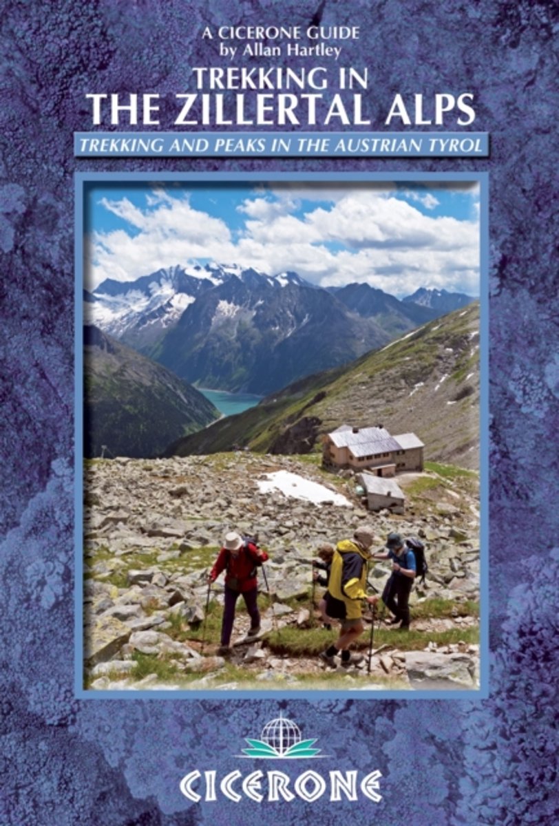
- Zillertal Alps: Trekking and Peaks in the Austrian Tyrol and Italian South Tyrol
- Trekking in the Zillertal Alps guide from Cicerone Press with two multi-day, hut-to-hut hiking routes presented with detailed descriptions and accompanied by sketch maps and profiles, plus a hut directory, etc. The two routes covered by the guide are:- Zillertal Rucksack Route (Berliner Hohenweg): a circular tour from Mayrhofen which links... Leer más
- Also available from:
- Bol.com, Netherlands
- Bol.com, Belgium
Bol.com
Netherlands
2013
Netherlands
2013
- Trekking in the Zillertal Alps
- This guidebook describes two popular hut-to-hut treks in Austria's Zillertal Alps. Both take eight to ten days to complete, with the option to add in day excursions from the huts to climb local peaks on both sides of the border, including the Zillertal's highest summit, the Hochfeiler. The Zillertal Rucksack Route, or Berliner Hoehen Weg, links... Leer más
Bol.com
Belgium
2013
Belgium
2013
- Trekking in the Zillertal Alps
- This guidebook describes two popular hut-to-hut treks in Austria's Zillertal Alps. Both take eight to ten days to complete, with the option to add in day excursions from the huts to climb local peaks on both sides of the border, including the Zillertal's highest summit, the Hochfeiler. The Zillertal Rucksack Route, or Berliner Hoehen Weg, links... Leer más
Mapas

Stanfords
United Kingdom
United Kingdom
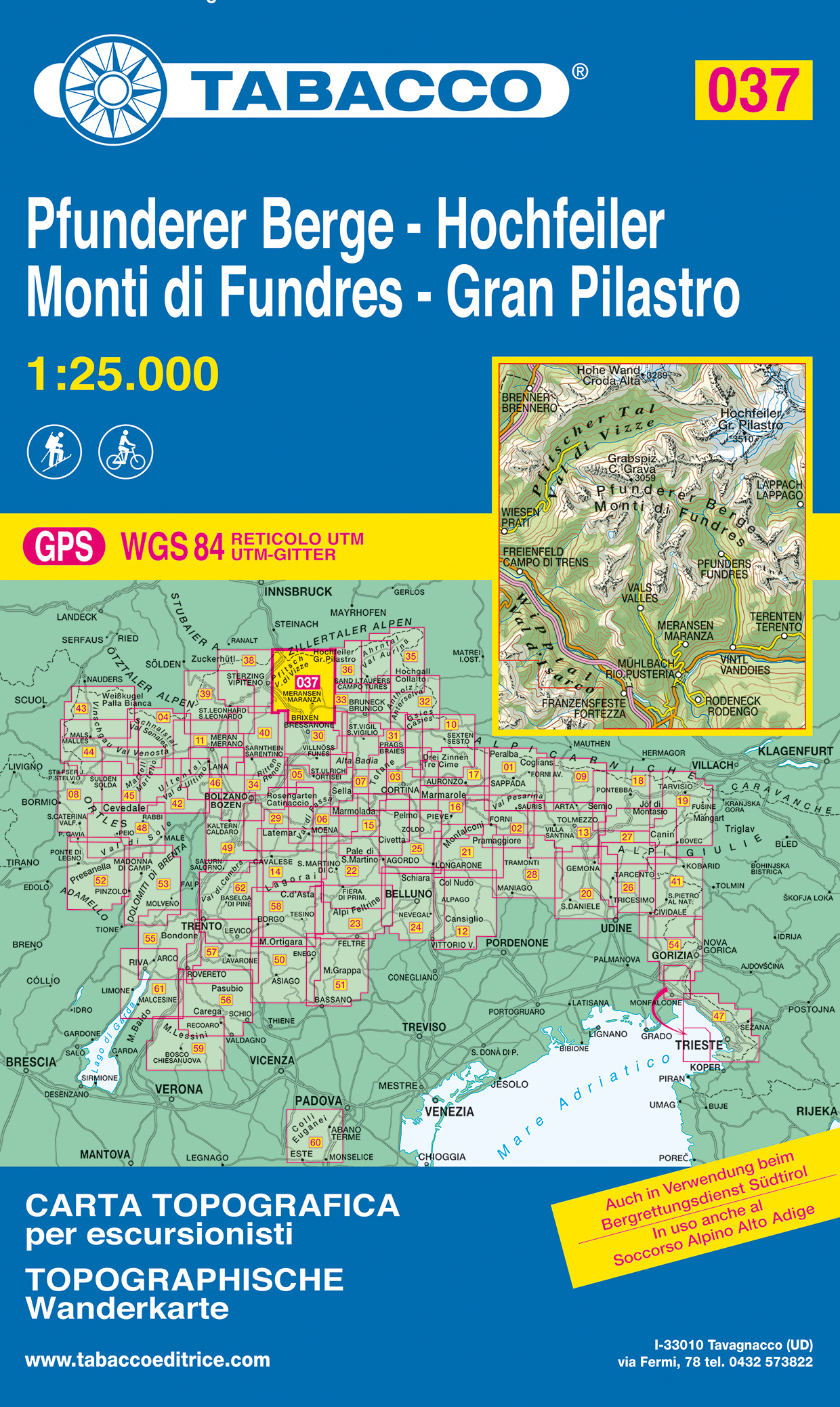
- Gran Pilastro / Hochfeiler - Monti di Fundres / Pfunderer Berge Tabacco 037
- Gran Pilastro/Hochfeiler - Monti di Fundres/Pfunderer Berge area in a series of Tabacco maps at 1:25,000 covering the Dolomites and the mountains of north-eastern Italy - Stanfords’ most popular coverage for this region, with excellent cartography and extensive overprint for hiking routes and other recreational activities, local bus stops, etc.... Leer más
- Also available from:
- The Book Depository, United Kingdom
- De Zwerver, Netherlands

The Book Depository
United Kingdom
United Kingdom
- Gran Pilastro, Monti di Fundres
- Gran Pilastro/Hochfeiler - Monti di Fundres/Pfunderer Berge area in a series of Tabacco maps at 1:25,000 covering the Dolomites and the mountains of north-eastern Italy - Stanfords Leer más
De Zwerver
Netherlands
Netherlands
- Wandelkaart 037 Pfunderer Berge - Hochfeiler - Monti di Fundres - Gran Pilastro | Tabacco Editrice
- Gran Pilastro/Hochfeiler - Monti di Fundres/Pfunderer Berge area in a series of Tabacco maps at 1:25,000 covering the Dolomites and the mountains of north-eastern Italy - Stanfords Leer más
Bol.com
Netherlands
Netherlands
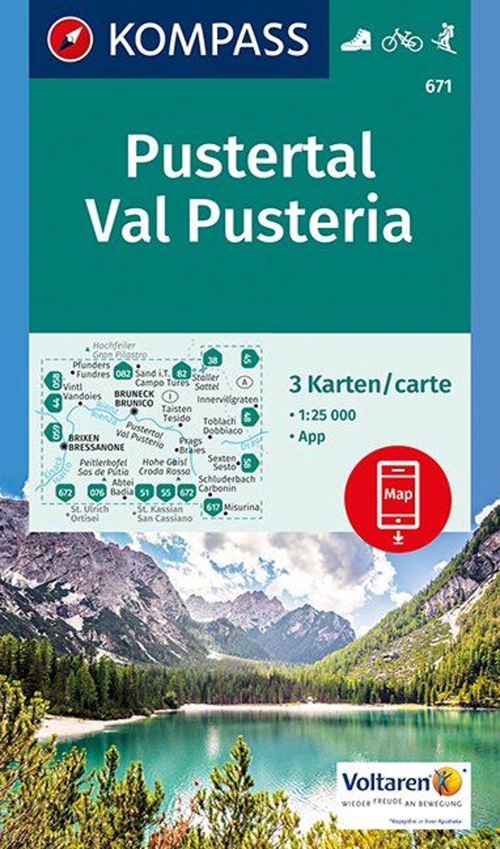
- Pustertal - Val Pusteria 1:25 000
- . Das rund 60 km lange Pustertal bildet die Grenze zwischen den Zentral- und Südalpen. Im Norden warten die hohen zersplitterten Dreitausendern der Zillertaler Alpen (Hochfeiler 3510 m), im Süden die senkrechten Wände der Sextener Dolomiten mit den berühmten Drei Zinnen.. Hauptort ist Bruneck, nach Norden zweigen das Tauferer und das Ahrntal... Leer más
- Also available from:
- Bol.com, Belgium
Bol.com
Belgium
Belgium
- Pustertal - Val Pusteria 1:25 000
- . Das rund 60 km lange Pustertal bildet die Grenze zwischen den Zentral- und Südalpen. Im Norden warten die hohen zersplitterten Dreitausendern der Zillertaler Alpen (Hochfeiler 3510 m), im Süden die senkrechten Wände der Sextener Dolomiten mit den berühmten Drei Zinnen.. Hauptort ist Bruneck, nach Norden zweigen das Tauferer und das Ahrntal... Leer más